


PRECINCT RIVERSIDE-C, Montgomery County, Ohio
About
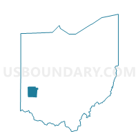
Outline

Summary
| Unique Area Identifier | 650310 |
| Name | PRECINCT RIVERSIDE-C |
| County | Montgomery County |
| State | Ohio |
| Area (square miles) | 1.86 |
| Land Area (square miles) | 1.86 |
| Water Area (square miles) | 0.00 |
| % of Land Area | 100.00 |
| % of Water Area | 0.00 |
| Latitude of the Internal Point | 39.77783940 |
| Longtitude of the Internal Point | -84.11177330 |
Maps


Graphs
Select a template below for downloading or customizing gragh for PRECINCT RIVERSIDE-C, Montgomery County, Ohio


Neighbors
Neighoring Voting District (by Name) Neighboring Voting District on the Map
- PRECINCT BATH TWP 275, Greene County, OH
- PRECINCT BEAVERCREEK 001, Greene County, OH
- PRECINCT BEAVERCREEK 092, Greene County, OH
- PRECINCT DAYTON 2-E, Montgomery County, OH
- PRECINCT PAGE MANOR, Montgomery County, OH
- PRECINCT RIVERSIDE-G, Montgomery County, OH
- PRECINCT RIVERSIDE-H, Montgomery County, OH
- PRECINCT RIVERSIDE-I, Montgomery County, OH
- PRECINCT RIVERSIDE-Y, Montgomery County, OH
Top 10 Neighboring County Subdivision (by Population) Neighboring County Subdivision on the Map
- Dayton city, Montgomery County, OH (141,527)
- Beavercreek township, Greene County, OH (52,156)
- Bath township, Greene County, OH (39,392)
- Riverside city, Montgomery County, OH (25,201)
Top 10 Neighboring Place (by Population) Neighboring Place on the Map
- Dayton city, OH (141,527)
- Beavercreek city, OH (45,193)
- Riverside city, OH (25,201)
- Wright-Patterson AFB CDP, OH (1,821)
Top 10 Neighboring Unified School District (by Population) Neighboring Unified School District on the Map
- Dayton City School District, OH (151,525)
- Beavercreek City School District, OH (53,697)
- Mad River Local School District, OH (21,847)
Top 10 Neighboring State Legislative District Lower Chamber (by Population) Neighboring State Legislative District Lower Chamber on the Map
- State House District 70, OH (123,974)
- State House District 38, OH (111,167)
- State House District 39, OH (92,594)
Top 10 Neighboring State Legislative District Upper Chamber (by Population) Neighboring State Legislative District Upper Chamber on the Map
- State Senate District 10, OH (343,341)
- State Senate District 6, OH (336,772)
- State Senate District 5, OH (318,239)
Top 10 Neighboring 111th Congressional District (by Population) Neighboring 111th Congressional District on the Map
- Congressional District 7, OH (683,371)
- Congressional District 8, OH (663,644)
- Congressional District 3, OH (640,899)
Top 10 Neighboring Census Tract (by Population) Neighboring Census Tract on the Map
- Census Tract 2001.04, Greene County, OH (6,615)
- Census Tract 903.02, Montgomery County, OH (6,296)
- Census Tract 2101, Greene County, OH (5,501)
- Census Tract 906, Montgomery County, OH (3,556)
- Census Tract 20, Montgomery County, OH (3,031)
- Census Tract 911, Montgomery County, OH (3,013)
- Census Tract 2803, Greene County, OH (1,832)
- Census Tract 907, Montgomery County, OH (1,437)
- Census Tract 908, Montgomery County, OH (1,334)
- Census Tract 9800, Montgomery County, OH (0)